- Thank You -
The History Of Sewaren
- Click Here To View an Authentic Stock From The Sewaren & Carteret (Central New Jersey) Railroad Company. (Dated 1899). -
- Click Here For A Picture Of A Picture Of A Ticket From The Old Train Stop In Sewaren, And Woodbridge. -
There has been A lot Of
Speculation Over The Years Where Sewaren Got Its Name
From. There Have Been 2 Different Stories In Particular That Provide The Same
Amount Of Strong, Credible Evidence. The First Story Is That The Dutch Settlers
In
There Is Also A Second Story That Is
Probably Stronger Than The First Story. When Sewaren
Was Considered A Resort Community, The Majority of the Waterfront Was Owned By
C.W. Boynton And The Boynton Family (
The Boynton Family was a Wealthy and
Prominent Family in
The Family Also Owned & Operated The Boynton Lumber Company, adjacent to
Boynton Beach, where Motiva/Shell is Today.
As I Said Before, the Waterfront
Section Of Sewaren, On
The Sewaren
Land & Water Club (also Known As the Sewaren
Democratic Club) was a
Believe it or not, there still is a Piece of the building's pavilion that still
stands today. If You Are On
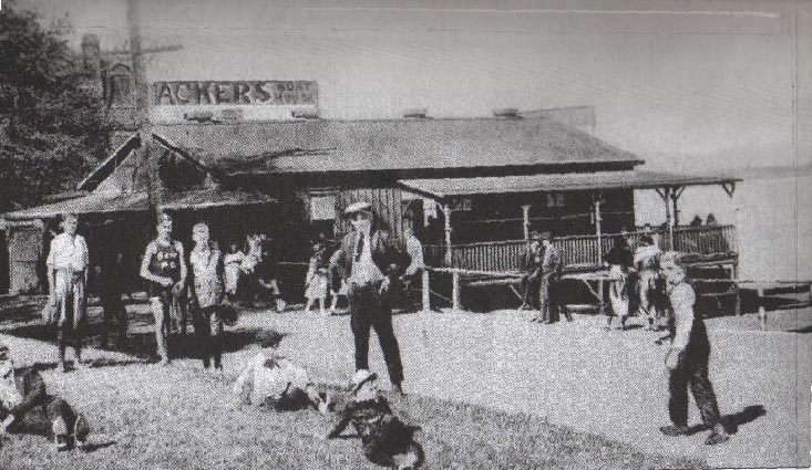
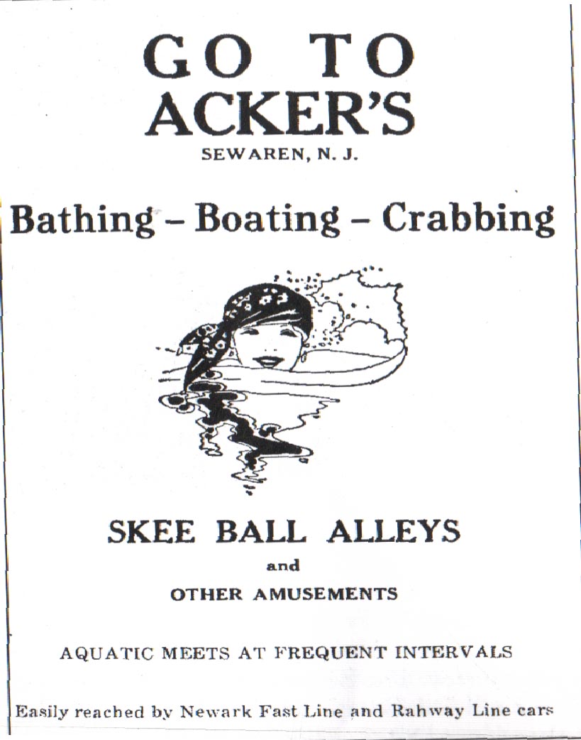
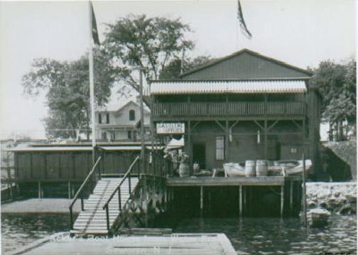
Mr. R.O. Acker rented hundreds of
Boats to Water enthusiasts. Ackers Landing provided many
Fisherman & Boaters with Rowboats to use all day long. The same area where the
Ferry Slip was in a major part of The
The House that is presently located at
537 West Avenue, next door to the Sewaren Corner Deli
was once located on Port Reading Avenue, when Port Reading Avenue was known as �The
Blazing Star Trail�. This House was the Headquarters for New Jersey Governor
George Livingston.� The house on
There was even a Hotel called The Sewaren House
Hotel. The Sewaren House was owned by a man named
Robert Deforest. The Sewaren House was built in 1878 and
provided lodging for
The Sewaren House was operated until 1913 and was demolished
a few years later.
Casmir �C.W.� Boynton, the Entrepreneur,
and the community man went forward to the
The Ferry Would Come To Sewaren Once In A While Before It Made Regular Stops At The
Sewaren House Hotel Every Day.
The
There were 2 separate Ferry ports in Sewaren.
The first one was a major Ferry service. The second Ferry was more or less of a
Small Boat that ran people back and forth, from
The Major Ferry transported people back and forth, usually from
In the Early to Middle 1800's, most
of Sewaren was Farmland owned By Sea Captains.
Captain John Holton (
In the 1870's, Mr. Henry Brewster purchased the Land that is now occupied from
The Landscape back then was so much different
than it is today. Most of The Land was Farms, Trees, and Marshlands. People
used to hunt where the Generating station on
People ask, "What did Sewaren Look Like 50 - 100 years ago?" A reasonable
answer is to take away 75 % of the houses.
In 1928 Shell Oil Company
bought most of the Property where
Shell Attorneys promised
On April 8, 1929, Shell Oil Company was allowed to move into Sewaren. This was a great benefit for Many workers especially
when The Great Depression began a Few Years Later.
With the arrival of the many
Industries alongside the Arthur Kill, saw the beginning of the End for
Ackers Landing lasted a few more Years after
Another Reason for the Demise of the Popular
On
One House in particular, the "Big White House" is arguably
the largest structure On
This House was owned by the Tomb Family. The Tomb's owned and operated The
Tomb's lamp shade Factory, around the Corner on
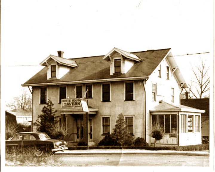
Moby Dicks was originally called The
White House. The Old White House, owned by the Joe, Archie, & Sadie
Andersch, was a popular social meeting place for people
that lived in Sewaren. Also after the development of the
Oil, & coal Factories in Sewaren, a lot of the workers
on the Ships went to the White House, as did the locals from Sewaren & they interacted. �The building was first used as a warehouse for
The Zylka Funeral Home in neighboring
The Andersch's operated the White house from 1940
until it was destroyed by a fire in 1970.
2 Other Taverns Were In Sewaren.
Turk's Tavern, at the end of Ferry Street and Ted's Tavern,
at the Entrance to Royal.
Now For history concerning the time frame
where a large portion of you readers may be more Familiar With.
Sewaren has always been a part of Woodbridge
Township, but on 2 separate Occasions, Sewaren could have
succeeded from
In February in 1922, the neighboring City Of
Then in 1961, a Small group of Sewaren and Port
Even though the Separatists fought hard for many months in Court and before the
State, their Movement Ended in May of 1962 as their case was Declared Unconstitutional.
There were Two Elementry
Schools in Sewaren.
Children living on the Northern End of Sewaren and
In 1969,
In 1988 The School was renamed
In the First Half of the Twentieth Century, up in to the 1970's, there was several
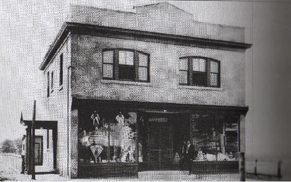
Stores In Sewaren, particularly
There were 2 Gas Stations - A Sunoco and
a Chevron. There was a Station where the Corner Deli is and across the street where
the
The Superior Diner was on Woodbridge Avenue, across the Street from
where the Peppermint Tree Nursery School now is, was a great place for Ice
Cream.
Fanny Firetag and her Aunt owned and operated Firetag's Store which was located
on the Corners of Woodbridge & Sewaren Avenue. Firetag�s was a Butcher Shop that Sold other Food as well.
Mrs. Kushner ran the Sugar Bowl, Located where PJ's Deli Now is, was somewhat a delicatessen and Candy
Store.
Across From Firetag's, next to the Superior Diner was
a "Milk Machine", which was a Self-Serve Vending
Machine That Sold Dairy Products. The Milk Machine was a popular hangout for
Kids as they got off the school bus.
On Old Road and the corner of Bobby Court, (the red house) was a Deli owned by Mr.
Stanley Jankowski. Mr. Jankowski sold many goods including - meat products,
small toys, and penny candy.
Carmella Giordano owned and operated Mella's Mop
Shop, a Hair Salon where all Of the Local Women went to Get There Hair Styled
And Talk Gossip. Mella's was where La Bouna Pizzaria now is.
Who could forget about Spoony's? Spoony
The Barber had Spoony's on Woodbridge Avenue,
Across The Street From The Post Office. Spoony Was
Well Known For His 10 Minute Haircuts. He Held a Record for giving the Fastest
Haircuts.
On The Waterfront, Kids went fishing
and Swimming in the Bay. An Old, Scruffy Man named "Captain Jack"
used to rent row boats to people for 50 cents an hour. His docks were on Cliff
Road, next to Jan & Jerry's Marina. A&A Tree Service now owns and operates
a marina and Boat Yard.
The Main, Ethnic Majority of Early Sewaren was Made Up of Northern Europeans, and Scandanavians, Such As Dutch, English, Scottish, Germans,
Norwegians, Danish, Irish, Made Sewaren Their Home.
Eastern Europeans, Such As Slovaks, Ukrainians, Hungarians, Polish, Italians
Etc, and a Few Other European Ethnicities Made their way into Sewaren. The Dutch were the first Europeans to colonize
However, Before any European Settler had
Made THeir way into Sewaren,
or any Other Part of Woodbridge Township, the Land had been the Home of the Sheyhichbi Sanhican Tribe of the Lenni Lenape Indians. These Indians
Had Occupied the Land Alongside the
The Indians and the European Settlers got along well. The Natives welcomed the
settlers on their land to share it. The two worked together and had a good
relationship. Unfortunately, things changed when a White Man was killed supposedly
by an Indian. After that, the relationship turned sour and both parties were
not as close as they once were. After time, though, they coexisted and lived friendly
side by side without any problems.
- AND NO PLACE ELSE
to view the pictures, just simply click onto the description of each photograph.
-
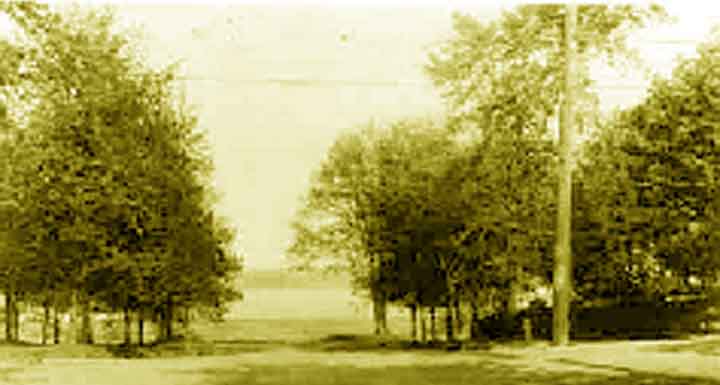
- The Sewaren train station. On the corners of Woodbridge & West Avenues - - West & Woodbridge Avenues-1800's. - - Another Picture Of The Sewaren Train Station. - - People Ariving At Sewaren. -
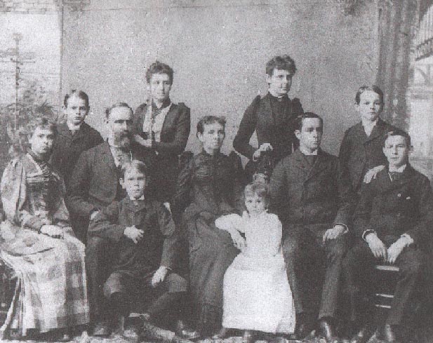
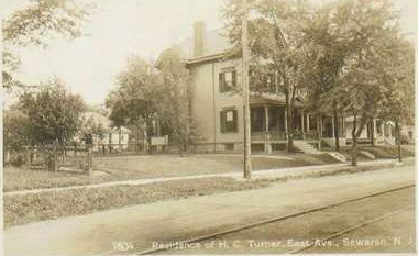
- Here Is A Picture Taken Of The Boynton Family. - - 449 west avenue turner house this house was a boarding house that mr. warren lived in. as you may recall as mentioned earlier mr. warren a worker for the boynton family. it is believed that sewaren was named after warren. Daniel Turner(1811 - 1887), The Man of the House, Was The Builder for Sewaren's Early Construction. was a Farmer in nearby Port Reading (Turner Street where School #9 is now. - - Here is another House That Belonged to Another Turner, Harry Turner (1857 - 1921). It is On East Avenue and still is to this day. The first house south of Woodbridge avenue on
the east side of East Aveneu with a brick facade. - - Another Picture of The Harry Turner House. This Picture Shows Harry Turner with his Grandson, Harry Howell. Prior to Living On East Avenue, Harry Lived on East Avenue. - The Sewaren House Hotel. - - the Sewaren House, Also Known As The Sewaren Hotel. - The White House Lounge. THEE "Watering Hole" of Sewaren 1940 - 1975. This Picture is from 1957. Can you guess what is the make of the Car in front?. Moby Dick's stands on the property currently. - Another take of The White House Lounge. THEE "Watering Hole" of Sewaren 1940 - 1975. -
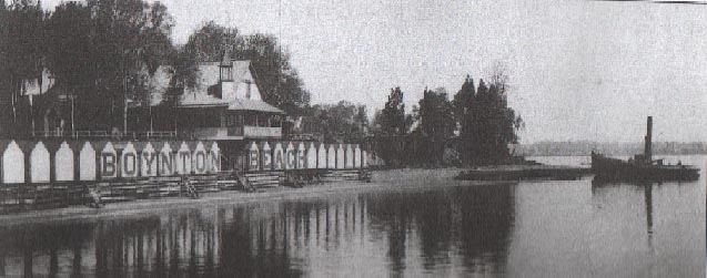
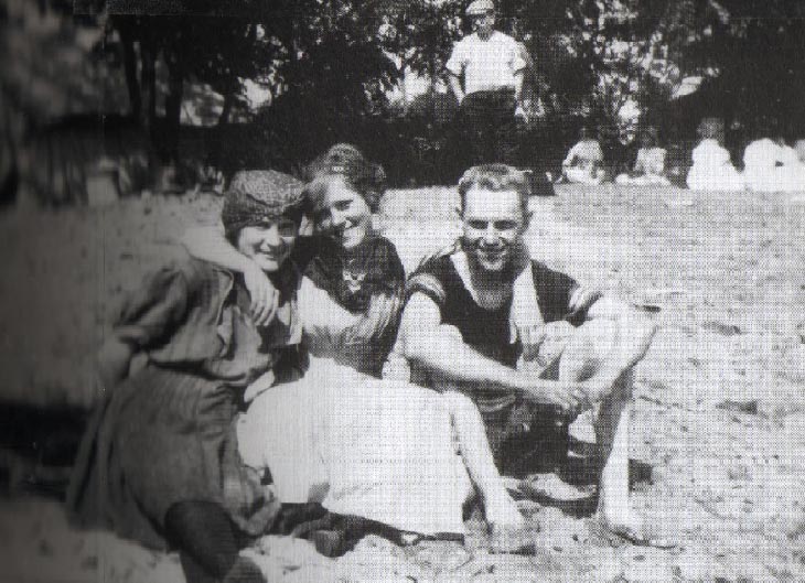
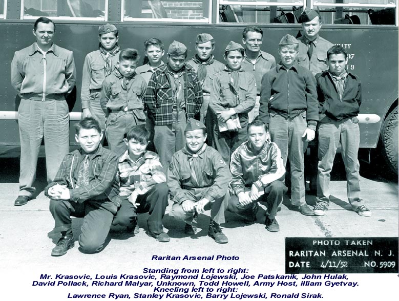
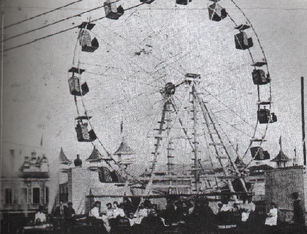
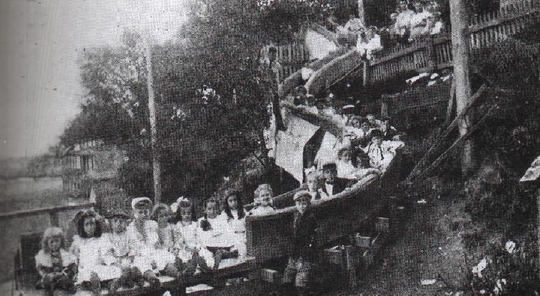
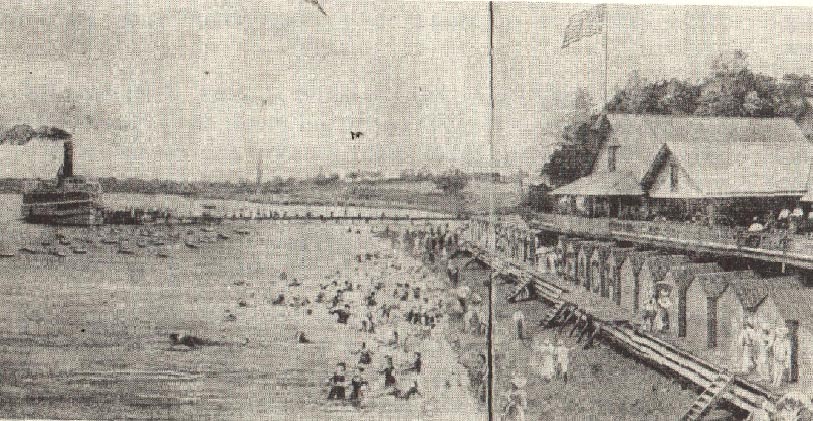
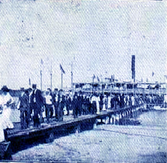
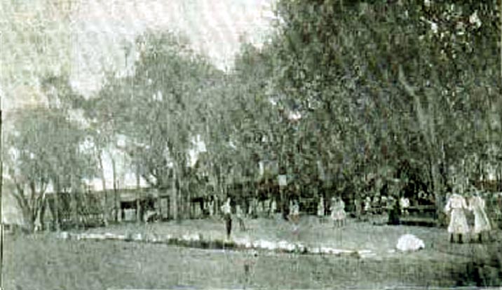
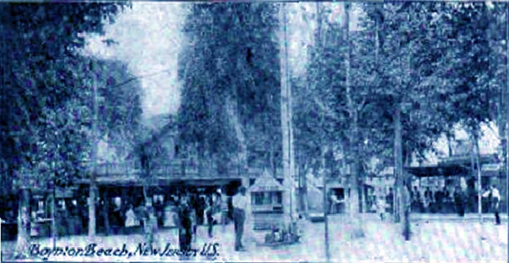
- the sewaren land and water club. this was also known as "the sewaren democratic club" the land & water club was a social organization that as located at the part of boynton beach known as pierces point. the area is now occupied by the shell oil company. - - boynton beach Advertisement Poster - - early sewaren waterfront. as you can see the many docks & boat slips. Ackers Landing used to supply rowboats for water - recreation enthusiasts. - Ackers Landing. - - A Poster Advertising Ackers Landing. - - Another Picture of Ackers Landing. - - The Shore Of Boynton Beach, Sewaren - - An Artist's Painting Of Boynton Beach - Here, A Few Friends Are Sitting On The Beach In Sewaren. Early 1900's - - Great Group Picture of the Sewaren Boy Scout Troop in 1952. - - the early sewaren public library. the building was once the home of the christian science church. the library was part of the woodbridge township public library system, untill a few years ago when funding fell short, and the township library system was forced into closing the sewaren branch, as well as other branches in woodbridge township. a group of citizens joined forces to succesfully rebuild the library, which is now called the free sewaren public library. - - One of the Best/Rarest Photos in My Collection. Woodbridge Avenue in Sewaren at an apparent Toll Both, or Possibly The Railroad Intersection. - - This is a Picture of the Ticket Booth at Boynton's. People Purchased Tickets Here for Admission to the Ferris Wheel & Other Amusements in the Park. Very Rare Photograph. - - Very Hard to Find Photograph. Here is the Shoreline, taken From Cliff Road near the Jetty. This shows the area that is presently built-up. - - The Sewaren Waterfront in 1912. At the tip of the Penninsula. - - This is A Large Restaurant at Boynton Beach. Many Hungry People are Flocking to It!- - Picnic Grounds. - - Here is a view of the Waterfront at Boynton Beach. There is a wooden Pier, in which persons would walk out to their boats. Also Shown is Ackers Landing. - The Dancing Pavillion at Boynton Beach. - - The Old Light House in Nearby Perth Amboy. - - Here Is The Ferris Wheel At Boynton Beach. It Was Popular, Especialy In The Summer Time. - - Kids Riding On The Bamboo Slide At Boynton Beach. Early 1900's -
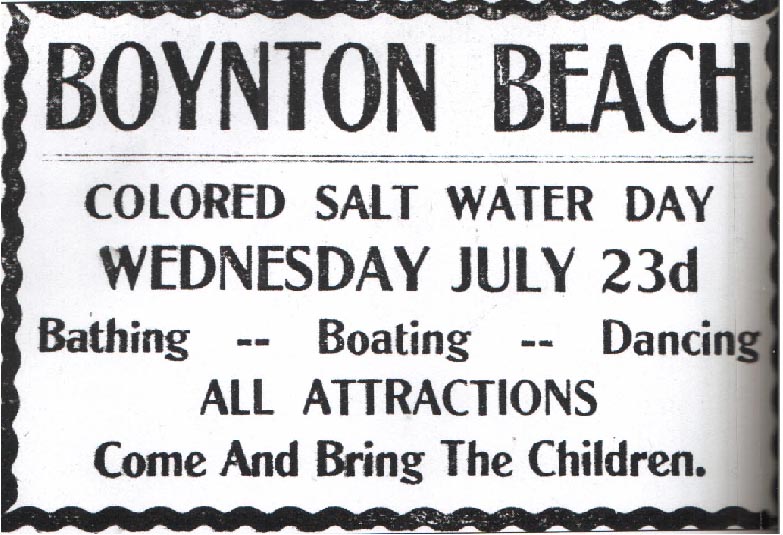
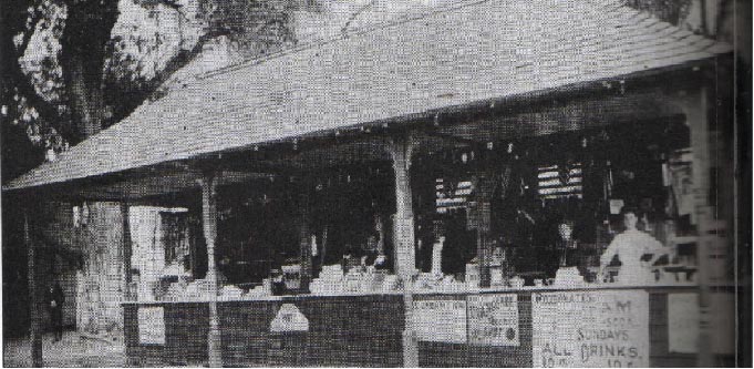
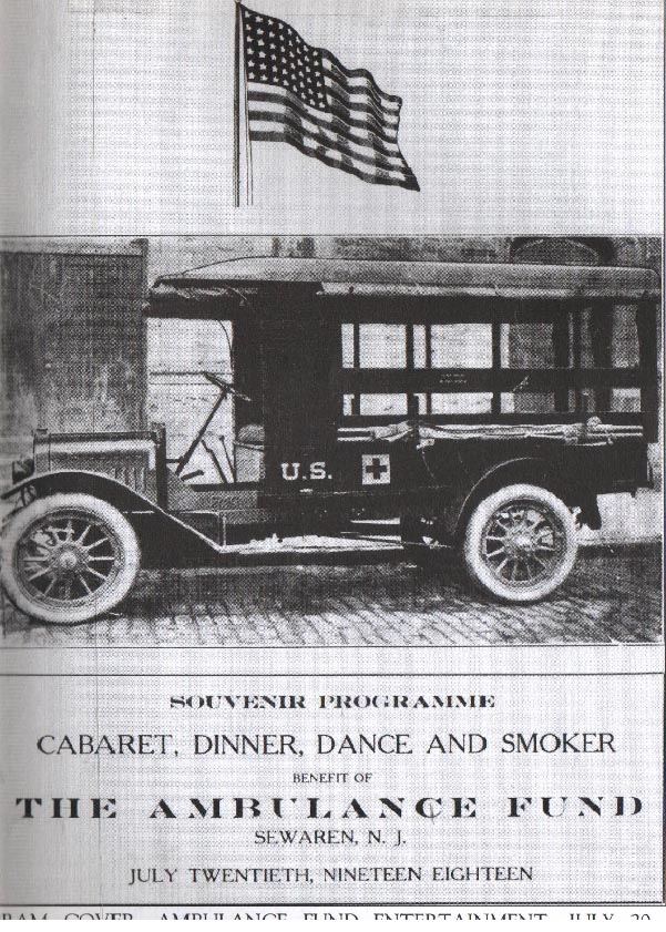
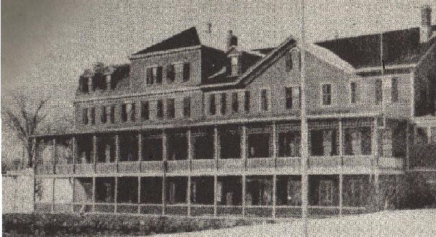
Here Is A Sign That Shows How Things Were Years Ago. During Segregation, Black People Were Not Alowed To Go On The Beach With White People, Therefor They Were Given A Day To Enjoy Boyton Beach. - - This Was A Food Stand At The Waterfront. When Beachgoers Became Hungry, They Can Just Go Here And Get Hot Dogs & Hamburgers, Or Soda & Drinks. - - Here Is Another Sign Of The Times. Late 1800's Photograph Of Boynton Beach Vacationers Taking A Boat Ride In A Row Boat. - - This Ambulance Was On Standby At The Waterfront In Case Of A Bad Event Were To Occur. This Ambulance Also Toured The World, Participating In Stand By For Many Large Events. - - Here Is Another Picture Of The Sewaren Land & Water Club, Also Named The Democratic Club By A Few. - - Here Is A Side View Of The Sewaren House Hotel At The Waterfront. 1920's - - An Early And One Of The Most Popular Ways Of Transportation To Sewaren, The Steamship Ferry. -
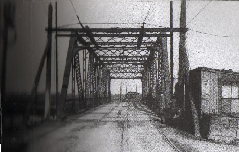
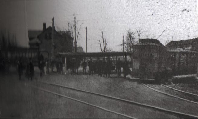
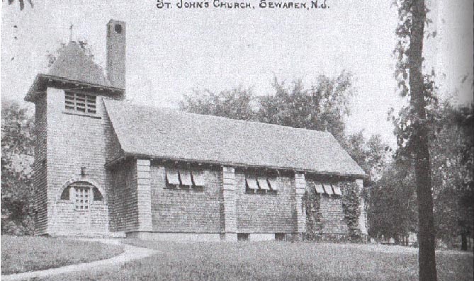
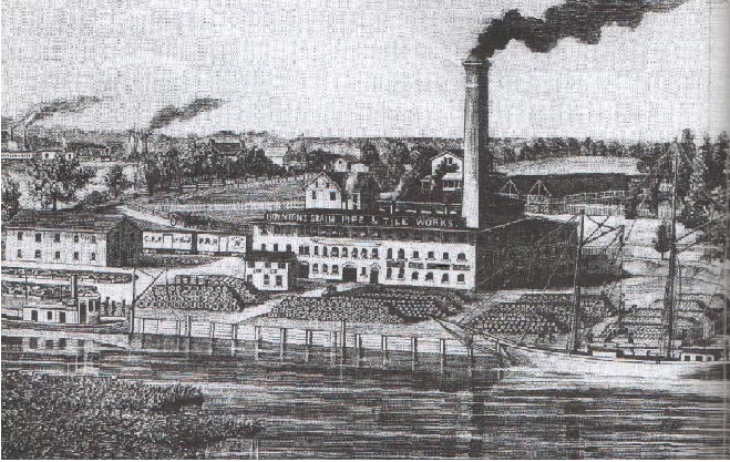
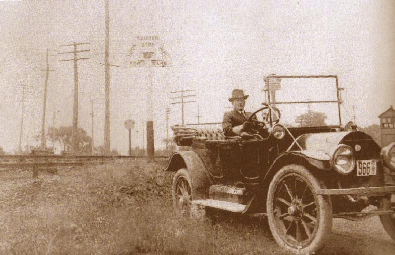
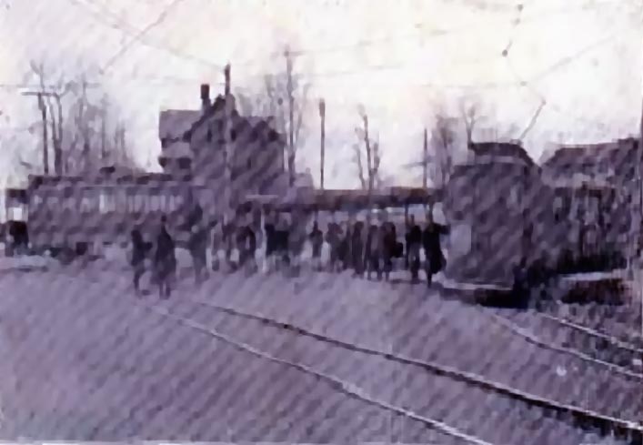
- A Picture Of A Local Method Of Transportation, The Trolley. Mr. Boynton Had Made An Agreement With The Electric Company And The Transportation Company To Provide Trolley Service Into Sewaren. - - Another Picture Of The Sewaren Trolley Service. - - Another Picture Of Saint John's Episcapol Church, In Sewaren. (1892) - - an artist's sketch of the sewaren waterfront. also shown is proposed plans to add to the waterfront. there is a current project being planned for the penninsula that seperates smith's creek from th arthur kill. the heavily weaded area is planned to have a park, nature trail and a walk way. - - indians fishing. native americans in the sewaren area took advantage of the arthur kill & the raritan river ' s vast supply of shell fish - - lenie lenape indians carving out ceremonial masks from trees. the arthur kill provided a vast supply of fish for these indians so it is much assumed that sewaren was the home for many indian tribes. - - some of the very first woodbridge township firefighters. the woodbridge volunteer fire department # 1 was formed in 1897. - the first woodbridge fire department apparatus - - C.W. Boynton's Clay Works Factory, In Sewaren - Clay Ships Docking On The Woodbridge River To Carry Clay From Valentine Brick Company. - Sunoco Station, corners of Woodbridge & West Avenue dated 1941. - - Sunoco Station, corners of Woodbridge & West Avenue dated 1941. - - Howard Johnson's on The Turnpike, Off of Calvin Street. (1950's-60's) Now Roy Rogers & Sunoco - Shell Oil Company - Sewaren Shell Oil Company - Sewaren Public Service Electric & Gas Generating Station - Sewaren - The Ames Building, On The Corners Of Woodbridge Avenue And Meade Street. 1930's - - Here Is A Picture Of West Avenue, Near The Railroad Tracks. When This Picture Was Taken, (1930's) There Was No Overpass At The Crossing. A Bridge Was Later Built.
This Is Presently Located Between Moby Dick's And Arbor Street. - - A Group Of Sewaren Friends That Spent Time At Boynton Beach. - These People Are Aboard A Sailboat Docked In Sewaren. - Visitors (mosty Likely from New York) getting off the ferry, docked at Boynton Beach. Area Shown Is The Picnic Grove. Picture Shown is Recreation Building of Boynton Beach - Swing Sets for Children. - - The Merry Go round at Boynton Beach. - Picture Is Of The Trolley Station In Sewaren. Trolleys Were The Most Common Form Of Transportation Around The Sewaren, Area. Area Shown Is Of The Picnic Grove At Boynton Beach - A Postcard From Boynton Beach -
- Dated 189O'S -
- Boynton Beach Was A VERY Popular Spot In The Late
19th Century & Early 20th Century. Here People Are Either Getting Off Of The Train Station, Or Going To The Beach, Or Pier. -
- Dated 1900's
Dated, 1920's.(Photo & Information Cortousey of Mr. Todd Howell, Woodbridge.)
- This Is A Full Frontal Picture Of The Hotel That Many People Spent Their Summers In During 1878 - 1913. -
- Dated 1900's -
People Who Spent Their Summers At Sewaren's Boynton Beach Usually Stayed Here. The Sewaren Hotel Lasted From 1878 - 1913. -
- Dated 189O'S -
(A very special thank you goes out to Rich Andersch, one of the sons of the former owner.)
- Dated 189O'S -
- Ackers Landing. During Hot Spring And Summer Days People That Were Vacationing At Boynton Beach, Or Even Sewaren Residents Can Rent Row Boats For The Whole Day. Mr. Acker Had Hundreds Of Boats On Hand So Users Can Spend Hours On The Arthur Kill. -
- Dated 189O'S -
boating, swimming, fishing were some of the many activities. -
- Dated 189O'S -
More Boats in The Water. -
- Acker's Landing From the Water. -
- 538 west avenue marsh - smith house this house is on west avenue in between the corner deli, and the library. this house was the headquarters of new jersey governer phillip carteret. this house served as a meeting place between the governer, several dignitaries and union soldiers who were coming to new jersy from staten island, new york. -
- Another Picture of the Ferris Wheel. -
- Another Picture of Concession Stands. -
- A Candy Stand At Boynton Beach.
- Tables & Picnic Benches At Boynton Beach. -
- map showing the close location of sewaren to many big locations, such as new york and perth amboy.
people that are unfamiliar with this area before the 197O"s are unaware that the city of perth amboy, which borders sewaren was one of the most popular places in the state of new jersey - if not the east coast.
perth amboy was a boom town that was noted for it's shopping districts, as well as a hub for employment with the many industries that were once in amboy.
this map gives the notion that sewaren was a prime location due to the fact that it is between perth amboy, and new york -
- Dated 189O'S -
- the sewaren trolley was one of the first forms of transportation by road. the trolley used to go throuh woodbridge, fords, perth amboy, and then to sewaren -
- Dated 189O'S -
- the ferry that would transport people from new york to boynton beach. in the 1890's, ferry transportation was about the only way to travel long, besides horse. the long pavilion was used for recreational purposes. the small shacks on the water's edge were shower stalls. the ferry would drop off and pick up passengers. most of these pssengers were new yorkers, many of them were wealthy. the ferry dock was located alongside cliff road. the ferry was located between the penninsula and where the boat launch/waterfront pier now stand. -
- this is a picture of another ferry. only, this ferry would transport people across woodbridge creek from perth amboy - to - sewaren. this was a small, simple ferry that was constructed from only simple lumber and wood. it was moved by a cable that ran from the shore lines of perth amboy and sewaren. the cost was only 2 cents. in the early 1900's, a bridge was built, which caused the end of this ferry business. -
- indians fishing. here the natives are making canoes out of wooden logs. -
this may be the very first picture of the newlly organized firefighters -
- Dated 189O'S -
water tanks being pulled by horse
- Dated 189O'S -
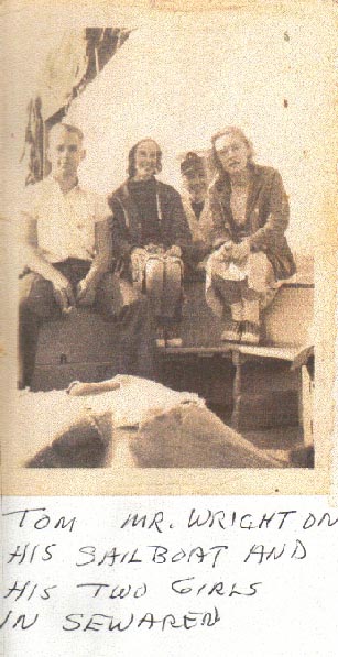
Next to The Right Is Tom Horner. -
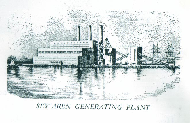
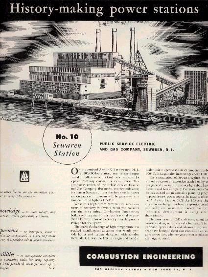
Picture Depicted Is Of PSE&G's Sewaren Generating Station - 1950's